» To understand Europe, you have to
» be a genius – or French. Right?
With every map there comes:
- a small version – the one you see, 500 pixels wide,
- and, underneath the image, a descriptive title
- a link to a larger version (1000 pixels wide) for download, and
- a link to the source.
Please note that the copyright license of our blog only allow the use of these maps for noncommerical purposes, and that moreover the license of most maps only allow their use for educational purposes. Thanks for respecting that!
Found another cool map? Share it!

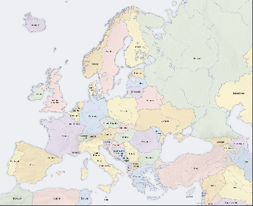
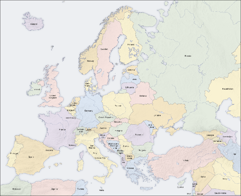
European countries today | Larger version | Source
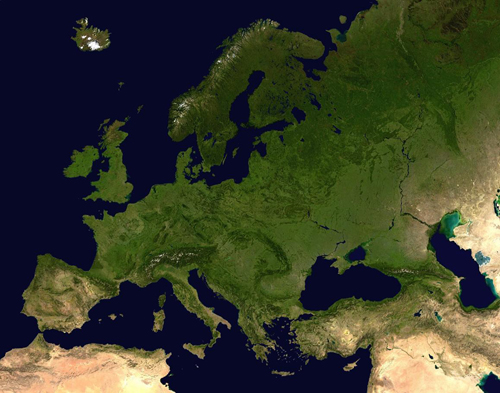
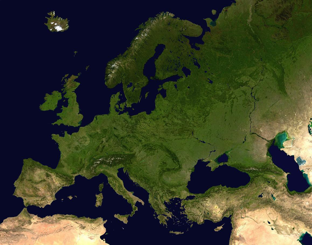
Europe from a satellite | Larger version | Source
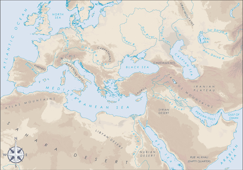
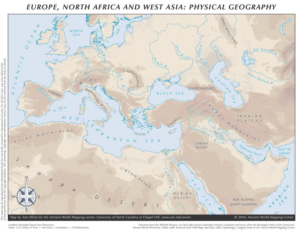
Physical geography of Europe | Larger version | Source
Europe on the globe | Larger version | Source
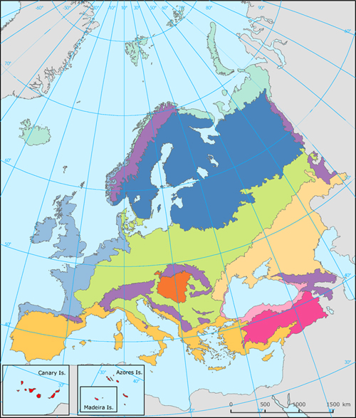
Biogeographical regions of Europe 2005 | Larger version | Source
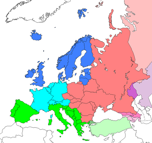
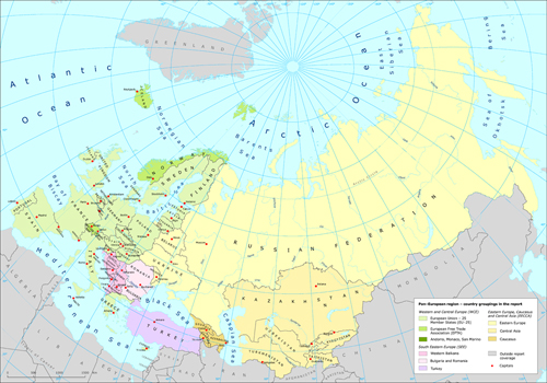
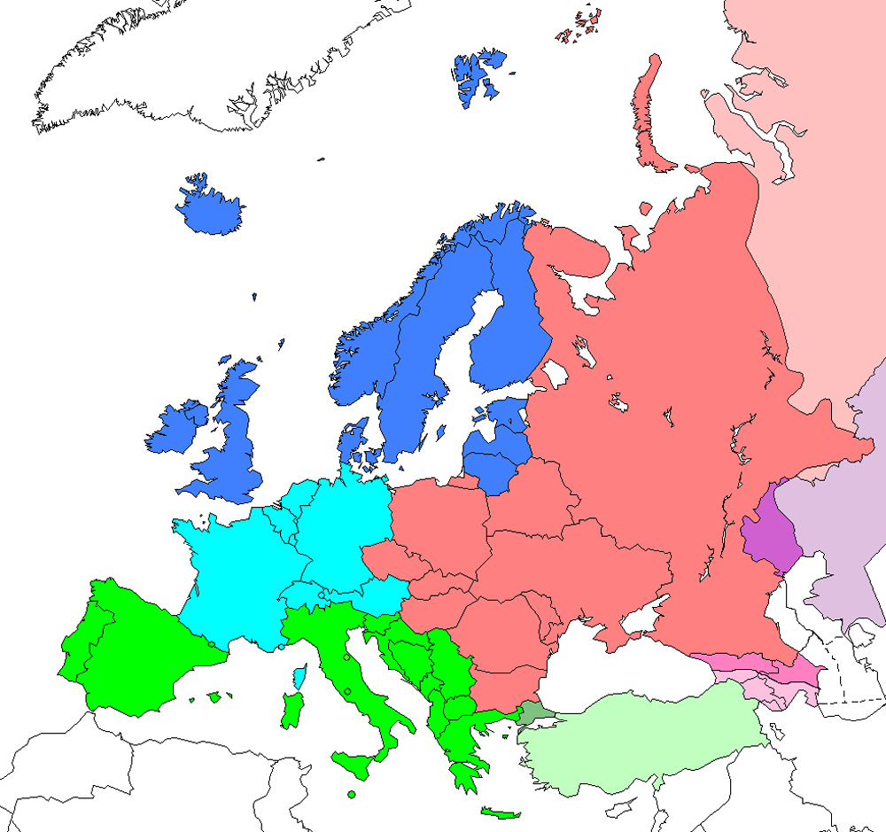
European subregions according to UN | Larger version | Source
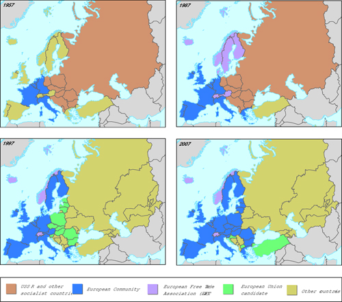
Political development of Europe 1957-2007 | Larger version | Source
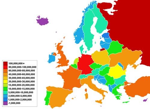
Overview population of Europe | Larger version | Source
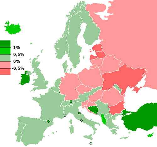
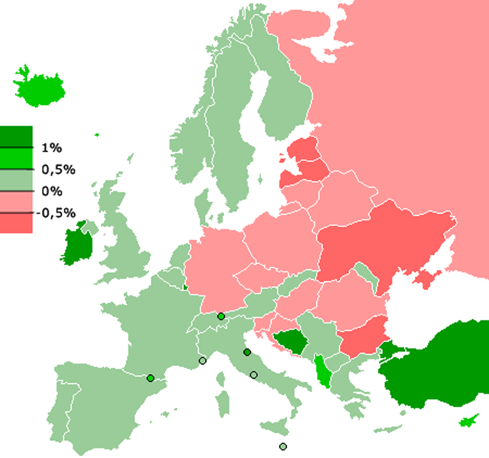
Population growth in Europe 2006 | Larger version | Source
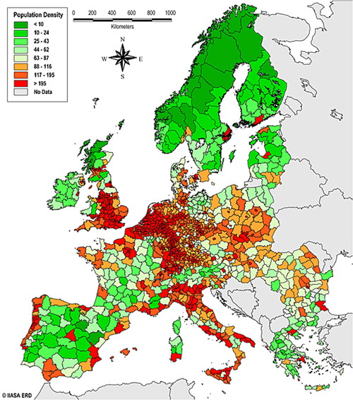
Population density in Europe | Larger version | Source
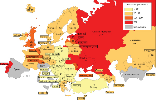
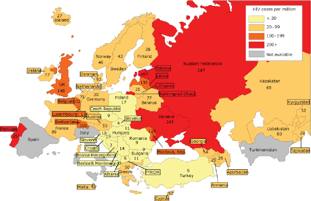
HIV cases in Europe | Larger version | Source

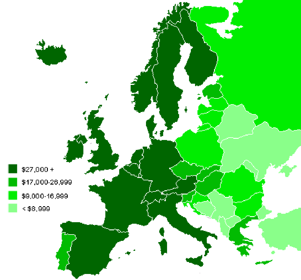
GDP per capita in Europe | Larger version | Source
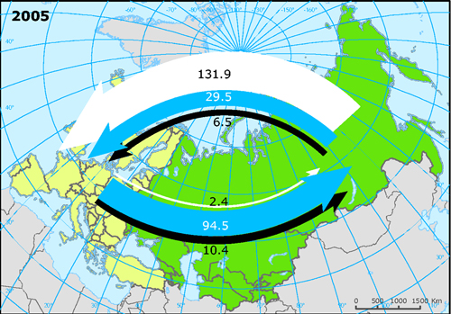
Trade between different parts of Europe | Larger version | Source

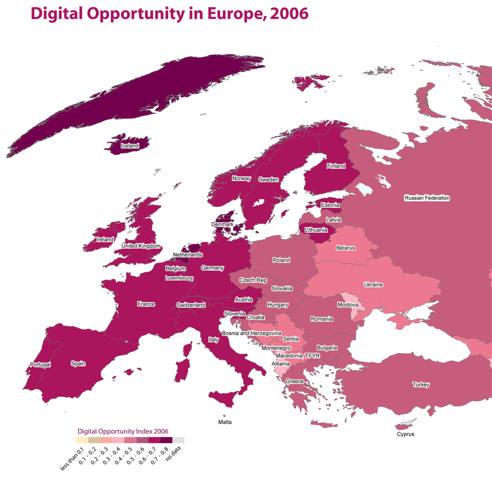
Digital Opportunity Map of Europe | Larger version | Source
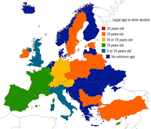
Legal age to drink alcohol | Larger version | Source | Further info
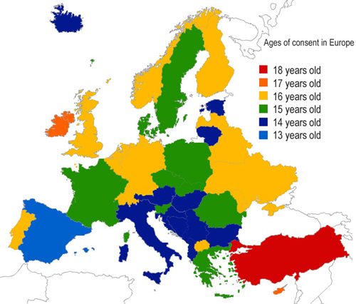
Age of sexual consent | Larger version | Source | Further info
Comments
One response to “Generic maps of Europe”
[…] Generic maps of Europe […]